
 Stirred to action by the COVID-19 pandemic, the US government has turned to OpenSpace to provide remote monitoring of building projects using the company’s on-site image capture technology.
San Francisco-based OpenSpace and partner JLL Technologies, the proptech arm of the real estate consultancy, recently won a contract from America’s Public Buildings Service (PBS) to deliver image capture at jobsites, as the government agency looks for a more efficient and resilient way of managing projects at its more than 8,000 buildings nationwide.
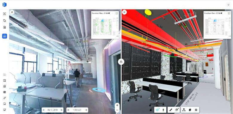
OpenSpace 360° reality capture technology records and transmits 360° images to give managers working remotely a look at a project’s progress. PBS turned to the solution after facing challenges keeping projects going in a portfolio of workplaces for more than one million government employees. The captured images can be matched to architectural drawings to ensure that the project is on track, without team members having to make site visits.
“Simplifying the lives of builders and professionals in real estate and construction is our main mission,” says OpenSpace CEO and co-founder Jeevan Kalanithi. “We’re proud that OpenSpace was selected as PBS’s enterprise solution across the US and are excited for the opportunity to save the government time and money with an easy-to-use, complete documentation system.”
Sophisticated, but Easy to Use
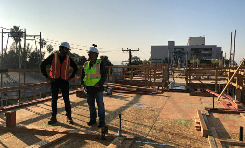
With OpenSpace Capture, users can attach an off-the-shelf, consumer 360° camera to their hard hat and walk the jobsite as they normally would, grabbing up to 150,000 square feet (13,935 square metres) of imagery data per hour. In just over a year since launch, OpenSpace collected 150 million square feet of imagery data — enough to fill the Empire State Building 50 times.
Once the video from a site walk is uploaded to the cloud, OpenSpace’s Vision Engine technology takes over, stitching images together and pinning them to the floor plan to create a trusted visual record of site status.
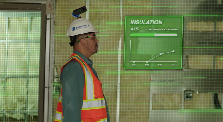 Vision Engine’s sophisticated AI tools enable the system to learn as it goes. After a few walks, the captured images — taken twice per second — automatically map to the client’s plans in an average of 15 minutes, not hours or days.
OpenSpace integrates with many standard tools of the trade, including cameras like the Ricoh Theta, Insta360, and Garmin VIRB 360. The system works on iPhones, iPads, and Android devices; integrates with Procore, Autodesk, and PlanGrid software; and can even handle images from 360° cameras mounted on drones.
Nationwide Rollout
OpenSpace and JLL/T will provide programme management support for the rollout of the image capture technology across all 11 regions of the General Services Administration, the PBS’s parent agency.
“With experience working with OpenSpace on our projects, we’re confident in our ability to deliver strong results together through our work with PBS,” said Liz Van Dyke, head of public institutions at JLL/T. “With our global expertise in construction and real estate management, we’ll support GSA in the rollout and use of OpenSpace’s technology across the entire portfolio, allowing PBS to realise maximum value.”

Jeevan Kalanithi, CEO, OpenSpace
Founded in 2017 by Kalanithi, Philip DeCamp, and Michael Fleischman, OpenSpace is an AI technology company dedicated to bringing transparency and efficiency to construction and real estate. To date, clients have used OpenSpace to capture more than 11 billion square feet of imagery from active construction projects in 91 countries.
The company has raised $200 million in capital from top-shelf investors, including JLL, BlackRock, Mirae Asset, and Sino Group.
To learn more about OpenSpace reality capture technology, visit the company website.
Leave a Reply